 |
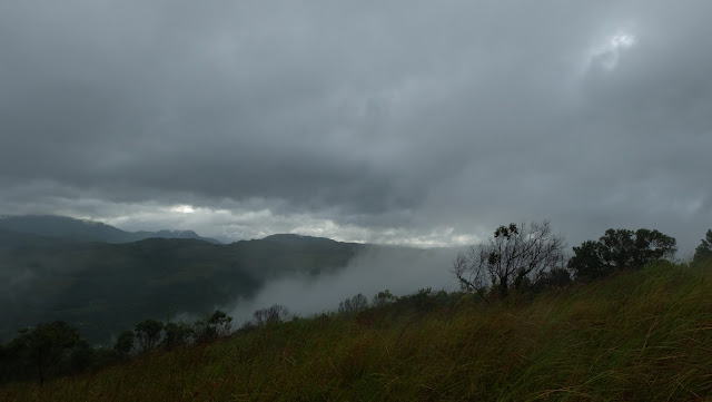
| Sea of clouds in my mind. Sunrise...where are you? |
 |
| Passed by rice paddies at the foot of the mountain. |
December 2018, I went along with someone with itchy feet to climb Mt. Batolusong, which is situated in Tanay, Rizal.This would be my first climb in the ranges of Sierra Madre so I had to find out how to get there. Since the weather that whole week was fine, we went on thinking that it would be a pleasant day and trail is dry... it's not. It started to drizzle as we approach the jump off point! We registered at the tourism office, hired a guide and waited for the rain to stop. I was really looking forward for the sea of clouds during sunrise but unfortunately there's none.
 |
| Approaching Duhatan Ridge. |
 |
| Yipeee! Picture, picture with the duhats! |
We didn't wait for the rain to stop, instead we climbed onto the steep phases going to the first summit which is the Duhatan Ridge. Obviously the name refers to "duhat" trees (black palm) that lined the ridge! And it seemed like they've been standing there for ages, just waiting for some fellowship or be photographed? There is a campsite nearby where we took shelter for a moment because it was raining hard, and it was also our chance to take a rest while sipping a hot cup of chocolate. Hmm... I can still feel the steam of the hot cocoa on my nose on that cold rainy morning!
 |
| Wait for meee! |
 |
| Welcome to Mapatag Peak! |
 |
| The grassland in Mapatag Plateau! |
Okay rain has stopped, no more excuses and off we climbed again but "oh my" the trail got muddy and slippery which made me slow because my shoes was loaded with mud! I was left behind, I kept on scraping the mud off my shoes to catch up! Step by step it didn't take too long we reached the second summit the "Mapatag Plateau"! The rain has stopped but the wind was howling that it can topple us off! The Mapatag Plateau is a long strip of grassland where people can enjoy the view of the nearby mountains and their summits! It is also a perfect viewpoint for sunrise and the sea of clouds which didn't show that morning. But I enjoyed looking at and listen to the sound of the grasses as it sways with the wind, hey I don't get to see that everyday!
 |
| Oh that peak? |
The climb wouldn't be complete without going to the third peak! I was hesitant of the
rock climb part because I was wearing denim jeans and it's pink! Hahaha. I was worried that I won't be able to step on the rocks because of my jeans! There is a rope that I can hold on but the problem was my stiff jeans! I got stuck in the middle of the climb! I got scared because the rocks are slippery and the cliff was just beneath the rocks! Lucky me my companion climb to the rescue and I felt okay...sigh.
 |
| Ang babae sa tuktok ng bundok. |
 |
| Happy kicks! |
Well I will see you again on my next blog. Ciao!
TAKE NOTE:
1. Mt. Batolusong registration office is in Barangay SanAndres,Tanay,Rizal. If you are taking a private vehicle drive along Marikina-Infanta Highway. A few kilometers past Masungi Georeserve, turn left to Santa Ines road, it is on the left side of the road. The road is dark so don't miss it, you will notice stores along the road, ask the locals.
2. Bring raincoat, it rains in the summit.
3. Apply sunblock too, just in case it won't rain.
4. Register at the tourism office and pay registration fee and environmental fee.
5. Get a guide, I know you're good but still get a guide!
6. Observe LNT policy. Put your trash in your bags, promise it won't kill you.
7. Camping is allowed.
THANK YOU FOR READING!
No comments:
Post a Comment