Thursday, December 7, 2017

Mt. Pinatubo Project

If not for the impactful eruption of Mt. Pinatubo, I wouldn't have any idea that it exists! Mt. Pinatubo erupted during my lifetime and it caused a devastating effect to humanity and the environment. I would only share in this blog some facts that I still remember last June 15, 1991. It was the day when everything outside of the house turned to white, and it was beautiful to look at because it looks like winter but it wasn't. It's ash fall. People living in Central Luzon were greatly affected by this disaster leaving behind their houses, farms, schools and livelihood. The towns on the perimeter of the volcano were flooded with thick lahar mud flows which destroyed settlements, agriculture and the natural landscapes. And it went on for decades. That day was Pinatubo's liberation day!


After 26 years, I am fortunate to witness the positive effects that Mt. Pinatubo had regenerated. I attempted to go to the crater three years ago but I backed out because of improper attire. Sturdy shoes is recommended when trekking to the crater due to the rugged terrain. Although an all terrain vehicle is needed to pass through the boundaries of lahar-filled roads, tourists will still endure the trails by and through streams, sands, rocks and dust.


At present the devastation of Mt. Pinatubo has left a dramatic scenery which is very appealing to tourists who spends time and effort just to get to the crater. Just imagine the long hours of walking amidst the mountains of lahar which is also prone to falling apart when wind, rain or earthquake trigger it.


A mountain of lahar.

The eruption also deposited nutrients to the soil thus making it more fertile to agriculture and provided adequate space for livestock. It also brought income to the locals mostly to the natives, the Aetas who works as tour guides and even store owners in the area at present.


I just can't imagine how many tons of lahar were spewed out of the volcano, that it had created mountain ranges of lahar. Well one thing is for sure, that the catastrophic effect of its eruption had left an amazing landscape that is at present beneficial to the natives that has suffered from its wrath.

If you want to experience the adventurous trip to the crater of Mt. Pinatubo, you can call Wendell Mercado at 63 919 608 4313 for complete details.
Thank you for reading!

Monday, November 27, 2017

Playground of the Gods-Mt. Pulag Part 2

Well, that's what the locals say, playground of the Gods and I believe. Year 2016 when I first climbed Mt. Pulag as my cross training for my half marathon run. I was scared not because of the height or the terrain but I was scared of the cold weather conditions that often drops at a low temperature. We stayed under a portable roof during my previous visit that kept me sleepless all night due to the howling winds and the ground which was so cold  that it penetrates through our mats and right into our flesh. And I just quivered all night. By the way, all those tents were toppled by the strong wind but not my ever dependable tent. But the good thing was that it wasn't raining and we had a good view of the sea of clouds and sunrise then!


Last Halloween I went back to Mt. Pulag together with some friends and that time I was more comfortable because I knew how to handle the situation already. That time, we were booked in a homestay, no more cold grounds but it was still cold because of the rainy weather. The smell of home cooked meals at Mam Agot's homestay filled the house which makes our stay more comfy.


We were already told by some trekkers that the weather at the summit was bad, and that they didn't make it! But we were still hopeful that the weather will be fine because of the promising sunset and the appearance of rainbow that afternoon!


Who would thought that it would rain on that early morning? We didn't make it to the summit, no sunrise, no sea of clouds due to the bad weather. Nevertheless I had a very good time walking around the village the day we arrived. I was able to see and do some things I haven't seen and done the last time I was there. Like walking on the winding road along the vegetable terraces that looks like an animated place.


Now you see me...


Now you don't!

Hanging out in the cafeteria in the town proper while drinking hot coffee and exchanging pleasantries with friends. Walking from one store to the other and  not buying anything? Isn't that fun?


My shoes had a lot of fun in the mud by the way!


There were assorted vegetables for sale in the town proper, very few stores were open for business during that time due to the bad weather.


Calla Lily are seen everywhere, actually they are very expensive when sold in the metropolis and here...they just grow in random places! Even succulents which are hard to grow are so abundant there or is it just me who can't grow them? Anyway, my last attempt to climb Mt. Pulag was not accomplished but I promise to go and face the challenge again, maybe I will try the difficult route next time. I am looking forward to new trails, and new places and new things to explore on my next trip! See you next time Mt. Pulag!


By the way, here is the link to my previous blog about Mt. Pulag. Thank you for reading!
Sweet Cold Embrace of Mt. Pulag Part 1


Friday, November 24, 2017

Magdapio Falls (Laguna Waterfalls Series)

Magdapio Falls in Cavinti, Laguna is also known as Pagsanjan Falls, the one famous for shooting the rapid boat rides.  Remember? Well since the watefalls is under the territorial jurisdiction of the town of Cavinti, the falls was renamed  as Cavinti falls. Magdapio falls is the indigenous name which was derived from its legend. The most popular way to reach Magdapio falls is from Pagsanjan, Laguna through an adventurous boat ride. The other way is by hiking from El Pueblo Salvador in Cavinti.


It was my dream to see Cavinti Falls, but the boat ride adventure from Pagsanjan is a little expensive, but of course the experience is worth the price. I've read from blogs that there's an alternate and much cheaper and more adventurous way to get to it! And that is through the vertical ladders in El Pueblo Salvador del Mundo. The El Pueblo Salvador by the way is an ecotourism park named after the patron of Cavinti. It is a forested area where tourists can enjoy nature, it has picnic groves and also serves as an alternative route to the waterfalls, caves and the river through the vertical steel ladders.


The images that I saw about the place gave me a certain feeling of hesitation. Oh my I've been thinking about it for a long time until some of my friends planned about it, and that I decided to go!


The steel ladders are firmly attached onto the cliff, well it better be, while we..hold on tightly to its railings during the descent. The park guides were helpful and patient enough in assisting us especially with the rappelling part. There are two cylindrical steel where we did a short rappelling, don't worry tourists are equipped with gears.


It only took us not less than a minute so it's not really scary but tourists can use the stairs if they don't feel like doing it, but it's more fun and faster through the rappel. By the way that's the first one and the other is in the lower part of the cliff.


 I know that I am almost at the end of the course when I saw the colorful boats along the riverbank that were almost within my reach! Yay! First challenge was done and my heart started to pump again. And so we started to prepare again for the next challenge, the Devil's Cave! And my heart stopped again.


The Devil's Cave is located at the back of Magdapio Falls, it begins with a raft ride that will be pulled by the boatmen until it crosses the waterfalls and into the cave! Whew! Sounds challenging?


Second challenge was done! Still feeling the adrenaline rush!  It was a fun filled experience, everybody went on screaming and giggling as we were approaching the falls and the cave! We stayed for a while, take photos and went to the steel stairs again to go back where we started. It could be tiring but the feeling of finishing the course is more than enough to overcome our fears and weariness.

How to get there? As I've mentioned from my previous blog, we went there by a private vehicle together with our guide from the Cavinti Tourism Office. We signed a waiver before we went to Magdapio Falls via the steel ladders. If you're planning to go there, I suggest that you wear dri-fit clothes because you will get wet for sure. Waterproof your gadgets for safety. By the way it is a nice place for picnic so bring food but be sure to dispose garbage properly. For more information contact Cavinti Tourism Office through their Facebook page. Thank you for reading!

By the way, here is the link to my first waterfalls visit in Laguna: Bunga Twin Falls (Laguna Waterfalls Series).

Thursday, November 23, 2017

Luisiana's Waterfalls (Laguna Waterfalls Series)

Part of  my waterfalls series are the waterfalls in Luisiana, Laguna. Luisiana mostly occupies the plateau atop the Sierra Madre mountains thus it is called the "Little Baguio of Laguna" due to its elevation and cool climate. My first visit to Luisiana was during our Visita Iglesia a long time ago. Peaceful and rustic was my first impression about the town. I never thought that this place boasts several natural attractions like waterfalls and caves!

Early this year I went with some friends in Luisiana to see the Hulugan Falls. Again, I never thought and never heard about it so I went! Going to Luisiana is just 2 hours travel from Manila, we passed by the towns of Pagsanjan and Cavinti and I think the last town in Laguna on the southern part is Luisiana. Anyway, as we were passing through the national road there is a signage of the Hulugan Falls, it is very visible so we didn't miss it. We paid the registration fee, a tour guide was assigned to us and parked the vehicle. It was a long road, you can either walk going to the jump-off point or take a tricycle.


Going down to the waterfalls area is steep, slippery and wet. If I will compare it to the trails of Bukal falls, Hulugan falls is more of the difficult round.  But we took it one step at a time, we have enough time so no need to rush. I didn't have pictures of it because my attention was focused on where I am stepping on and holding on. I think it took us about an hour before we arrived at the falls area.


The challenging round ended as I saw the long and big waterfalls in front of me! Oh my it is beautiful! I swear it looks like a huge white curtain adorning the middle of the forest! It was such a great feeling to be up close to that waterfalls. We spent some time taking photos and enjoying the moments.


Later on we moved on to the next waterfalls, and into the forest we went! We trekked higher and passed by a place where tall pandan trees are grown, and it looks like we were in another dimension. The pandan is one of the main sources of living of the locals, its leaves were dried and made to bags, baskets, sleeping mats and other useful items. I wanted to spend  more time in that area of the forest but we have to move on and find the other waterfalls.


Talay Falls is how they call it, it is located deep in the forest. I was amused with the variety of small flowers along the way it kept me busy from taking photos of them forgetting the heat, sweat and hunger.


As usual that sound of water gushing says that we are nearing falls number 2! Woohoo my tummy was grumbling already,  and we arrived at our destination just in time for lunch! We ate lunch in open air beside the waterfalls with the flowing sound of water as background music...how relaxing! After lunch it's photo opportunity at Talay Falls. This waterfalls is not high and it is hidden behind mossy boulders. It can be reached through climbing on the second level from the picnic area.


It was time for us to move again and find the way to Hidden Falls. The trek to Hidden falls is steep and slippery, there is a part that requires rappelling so we can walk on to the part where there is nothing to hold on to. The path is very narrow and there were dilapidated tree trunks on the way which I thought was not good to step on. And finally, we saw Hidden falls! Well the falls can only be seen by climbing onto the boulders, that's why it's called hidden. It is smaller than Hulugan falls but more splendid.


So mission accomplished in Luisiana! Our nature tripping was done! All was well and ended well. Maybe I'll be back to Luisiana for another adventure in the future. I've read that there are caves to be explored but not open for public yet...maybe soon.

How to get there? We went there through a private vehichle so I can only give you the direction from Pagsanjan, just follow the national road going to Cavinti then Luisiana. Do not miss the signage of Hulugan Falls on the right side of the road. Go to the registration office and start your adventure! Have fun! Until my next waterfalls adventure!


Bukal Falls (Laguna Waterfalls Series)

Whenever I thought of lush mountains, waterfalls, caves the first thing that comes to my mind is Laguna. It is always Laguna,I have fond memories of Laguna, during my childhood where I usually spend my summer vacation. Everything I saw, heard, tasted and felt is still clear in my mind. The fried mud fish dipped in sweet sauce was a yummy treat, there was also  "cuchinta" a sweet delicacy made from rice flour was so chewy that every bite of it was truly enjoyed. The cacao fruit that we ate and seed was put out in the sun to dry and later made to cocoa was fun. The exciting passion fruit or granada with seeds that explodes in my mouth well, that's why it's called "granada". All of these memories will be forever be remembered.

Anyway, now that I'm older I still love Laguna, it's a quick getaway if you're tired and bored of the metropolis. Laguna is so gifted with natural resources, they have mountains, lakes, forests, rivers, waterfalls, you ask they have it! I have no idea how many waterfalls are there in Laguna, I only visited a few and I know there's still more, somewhere in the wilderness. Bunga twin falls in Nagcarlan was my first waterfalls to visit.


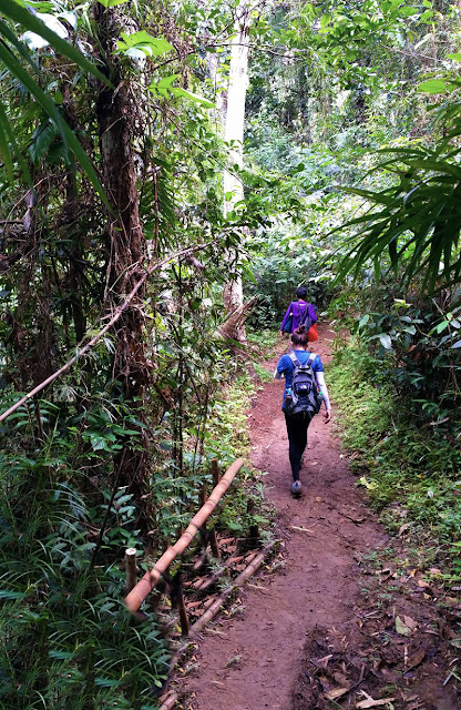
Well another waterfalls not to be missed is the Bukal Falls in Majayjay. Bukal falls is located at the foot of Mt. Banahaw in Barangay Bukal and can be reached by trekking through a narrow paved pathway along lush vegetations. It was raining when we walked along the muddy and slippery trail but it didn't matter.There was a small hut where we stopped for a while before heading to the falls. They sell coconuts and snacks, there are benches where tourists can stop and rest. Tourists can also use their comfort room for a small fee. We hired a local guide because the trail leading to the falls is steep and slippery and that the guide could guide and show us the safest route.


We started walking after some refreshments and we were greeted by these signboards, it says "Be Careful Steep", so we were very cautious!


We went down on this wet and mossy trail slowly clinging onto the railings for about some time, I wasn't sure how many minutes it was. What I know was that it's 30 feet deep.


Well anyway, I was relieved when I saw the signboard and the people walking along the clear stream.  I knew we were almost there!


It was a nice feeling as I crossed the clear and cold water carpeted with colorful stones and surrounded by mossy forest, I started to feel that I am away from the chaotic world of the metro at that moment.


There is a bamboo bridge, a typical rural scene. It was creaking as people passed by and that sound made the wandering more exciting!


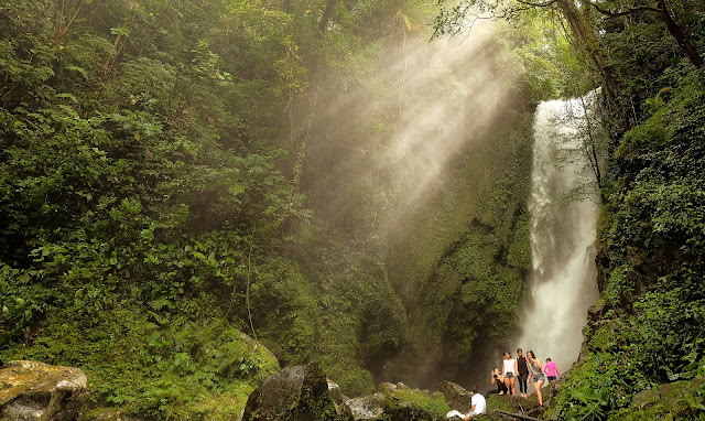
Slippery boulders were along the way, so we must be very careful. Not too long, a grand  body of water were falling heavily and loudly from thick green trees, the rays of the sun peaks in between its leaves and tiny droplets of water covered our faces, the sound of water became louder as we went nearer.


That's it Bukal Falls! The Enchanted Falls as what it's also called. I don't know why, maybe it's secluded that it looks like it's inhabited by supernatural beings that protects the forest. I thought we were lucky to go there on a rainy day because the flow of water was heavy so I think it is best to go there during the wet season unlike during summer but be very cautious sometimes the current becomes erratic.

How to go there? Go to Barangay Bukal in Majayjay, Laguna and go directly to the Barangay Hall for registration. You have to pay a minimal fee of 20 pesos, hire a tour guide and you're good to go!
Enjoy!

Thursday, April 20, 2017

Calayan Island Dream


I became interested about Calayan Island after my Palaui Island trip 3 years ago, but its location in Luzon Strait made me think that it would be impossible for me to get there, for I know it would be a very long and risky route. It was unexpected that someone invited us to come, I was like...uuhh? And answered "yes" with conviction. Calayan Island is one of the major islands of the Babuyan Islands in Aparri, Cagayan. The Calayanos speaks Ibanag and from my observations they're one of the most diligent and honest people I've met.

Lampitaw ready to rakenrol!


You know, as the D (departure) day comes, I was getting scared. I read blogs about the place and that 5 hour sea travel makes me shrink. There were many stories about how dangerous it was to be there and I am not a good swimmer. Oh well, I'll be crossing the bridge when I get there. But there's no bridge!

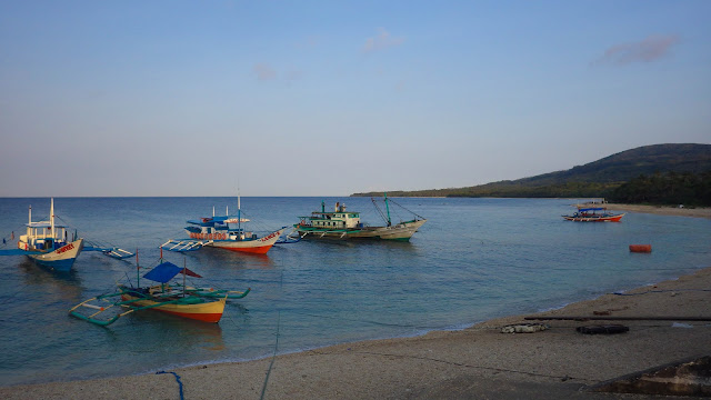
The only way to get there is through the local boats called "lampitaw" (lam-pee-taw) which braves the rough and unpredicatable waters of the Philippine Sea. Oh my God, this boat is not for the gutless! Sailing across the jagged surges of water for five hours will make you call all the saints and angels. Prepare to get wet, apply thick layers of sunblock lotions or be like dried tomatoes in the end. Bring raincoat and your own life vest because some of these boats doesn't have enough to provide for their passengers, and seal off everything! The "lampitaws" leaves the port at 6 AM everyday depending on the weather or wind conditions with the guidance of the Philippine Coast Guard who decides if they can sail or not. They say the best time to go to Calayan is during the months of March and April where rainfall is less. Although it is still not an assurance, there is a possibility of getting stranded in the island for days due to wind and wave conditions. You know like little wind and waves will surge? Clusters of clouds and the ocean will be violent? But no rain? Things like that!

We arrived safely but soaking wet past noon in Calayan Island and greeted by some tourism officers, a "kuliglig" (a rural vehicle with two-wheeled trailer pulled by a hand tractor) brought us to the resort where we would stay. It was my first time to ride in a "kuliglig" and it was fun! This vehicle can take 8-10 passengers to their destinations slowly but surely.

kuh-leeg-leeg

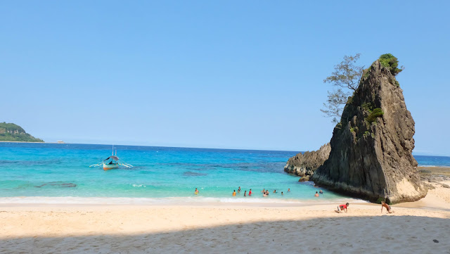
Anyway, let's get on to the some of the interesting places I've seen in the island. Sibang Cove is one of my favorite. Its pristine water and soft sands makes this place a perfect place to unwind and talk  and thank Mother Earth for this wonderful gift of nature.

Don't blink!


You can get to Sibang Cove by hiking or by boat. Just ask the locals and they would be glad to help!


Goats: Can you please stop following us? Meeeeee!
We went to Bangaan Hills on our first day, it's just a few minutes hike from the town. Bangaan hills has a wide area of grassland which is enjoyed by trip of wild goats and from its edges is an overlooking view of the heaven and sea.


Immense!

The next day we explored Lussok Cave, it was an hour boat ride, located on the other side of the island. The cave which looks like a mouth of a whale ready to swallow all of us has some chambers and a home to bats and birds, there are sharp and slippery rocks on the way to the mouth of the cave so it's advisable to wear the proper water shoes so you wont get hurt. There are natural pools in the cave where tourists can dive or simply take a dip.


Nagudungan Hills and and the lighthouse are also included in our itinerary and it shouldn't be missed. They're just walking distance from Sibang Cove, you can see the lighthouse from the cove but it is not operational anymore because it was destroyed by a strong typhoon. 


The Nagudungan Hills looks so mystical, it's enchanting. The pine trees on top of the hills goes with the wind which makes them uniformly stands in the same position, there's a cliff in the middle of the hill where caves are visible below during low tide.


Honestly speaking, I was so scared taking a photo of this cliff, the wind blows so hard as if it can carry me towards the big hole!

On the third day, we were planning to leave the island but due to weather conditions, well I meant the wind and waves situations, the coast guard didn't allow anyone to leave the island for safety, and everyone must abide!

Since there are still a lot of places to go to, we might as well take advantage and just enjoy the days being stranded. Now let's go to...tappuaken reef (jump site) and jump!

Are you ready to get wet?
I think the easiest access to go is through Bangaan Hills, where there is a rocky trail going down. People jumps from those boulders below and straight into the clear water! Stranded Day 1 was fun!

We made another attempt to go out of the island the next day but still negative so how do we make use of the day again?


Go to the forest and trek, find something beautiful and promising. Blend in with the flora and fauna, take pictures and listen to what the forest is saying! Find waterfalls and take a dip! Watch the damselfly hover from one stone to another, do some things that we don't usually do everyday! That's how we spend stranded day 2!

Cabudadan Falls
The Calayan town proper or "Centro" as they call it, gives an impression of how industrious the Calayanos are. It shows in the way they maintain their environment. It has zero crime rate so they can leave their house doors open at night. Townsfolk are amiable.

My favorite house in the island. 


Calayan Municipal Hall

Calayan Island Port

Catholic Church

School.

Calayan Island is a paradise. The beauty of if doesn't only show in the elements of their natural world but also in the hearts of the natives thus they deserve to coexists with one another.

So to those who are planning to go to the island, let us be respectful to locals after all we are only strangers in their paradise.

Lastly, I would like to thank those people who made us part of this trip and if you will ask me if I am going back there...yes! When the airport is done. By the way, there is an ongoing construction of airport but it will take time.

Note: Photo of Calayan Island map is courtesy of Wikipedia.

HOW TO GET THERE?
1. Take a bus  or car going to Aparri or Claveria, it will be a 12 hour travel so be patient.
2. The ports going to Calayan Island are in Aparri, Claveria and Sta. Ana. The shortest travel is via Claveria which is 5 hours.
3. The boats leaves as early as 5 AM everyday depending on the weather condition, if it is not permitted to go you have to wait for the coast guard's advisory about the departure.
4. Upon arrival, go to the tourist center and register.

REMINDERS:
1. Expect to get wet in the boat, bring raincoat, sunblock or wear long sleeved shirts, hat and snacks for the 5 hour sea travel.
2. Bring cash, there are no ATMs in the island.
3. There are homestays and resorts where you can stay during your vacation, just ask the locals and they are  willing to help.
4. Grocery stores and eateries can easily be found in the town proper.
5. There is always the possibility of getting stranded in the island due to weather condition so be patient and make the most and enjoy the island.
6. No electricity from 12 MN until 12 noon.
7. Don't forget your cameras! My gosh!
8. It is advisable to bring or wear dri fit clothes so it's lighter and easy to wash in case you get stranded.
9. No Globe signal, Smart only.
10. Respect the locals, DO NOT LITTER!

DREAMS DO COME TRUE.

ENJOY!!