Thursday, March 26, 2015

Maragondon Travel On Foot

The travel from Manila to Maragondon wasn't bad at all, the traffic flow was light and we arrived at the town proper just in time. Maragondon (muh-ruh-gon-don) is a municipality in Cavite, its name was derived from the tagalog word "madagundong" (prolonged loud noise) which sound comes from the rowdy river "Kay Albaran" and presently called Maragondon river. The town proper is accessible from the highway so walking is preferable to get around the place. We started our tour in the parish church, Nuestra SeƱora de la Asuncion (Roman Catholic), popularly known as Maragondon Church.


The only church in the province of Cavite declared by the National Museum as a National Cultural Treasure. After undergoing several renovations from 1630 it was finally completed in 1714. The narrow bell towers stands as buttress which supports the main building which was basically made from river rocks.


The church's faded door was carved elaborately with flowers, ships and castle which gave more emphasis on its design due to the building's simple architecture.


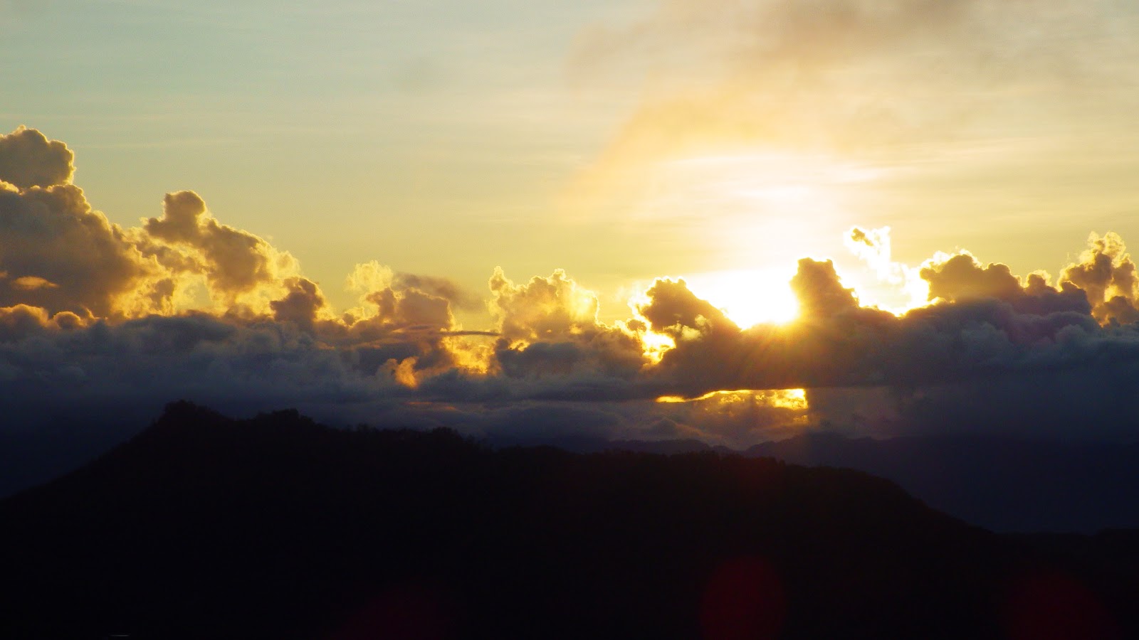
The interior of the church ceiling is supported by long, thick hard wood with biblical captions carved on each beams. The well-polished retablos are adorned with angels, leaves and columns. The stairs of the bell tower are partly dilapidated and the smell of bat manure emits an unpleasant odor, but all the discomforts went away as we saw the aerial viewpoint of the Maragondon River and the town proper.


There are also heritage houses in Marogondon as we walked around the town, there were those which are already in bad condition and needs total rehabilitation, and I wish the local government would pay attention on the situation.


The house of Emiliano Riego de Dios stands in one of the main streets of Maragondon, it is still in good condition, and at present the house is privately owned. Emiliano Riego de Dios was born in Maragondon, he is a member leader of "Katipunan", a revolutionary society during the Spanish regime in 1896. It is said to be one of the old structures in Maragondon, Cavite.


Another beautiful ancestral house in town is the Punzalan Ancestral house. I don't have much information about the house but it seems that it looks very impressive during the times when it was still on its finest. At present the house is privately owned, but you can still come and take pictures of it. Walking around the town is just like tracing past events which has a significance to our history.


The Bonifacio Trial House was on our list of houses to visit and we were so lucky enough to be allowed to come in because it was being painted and decorated at that time in preparation for Andres Bonifacio's birthday. This house was erected in 1889 by its owner Teodorico Reyes. The house where Andres Bonifacio the founder of Katipunan and his brother Procopio were court martialed. Despite the fact that there was not enough evidence they were found guilty of treason and sedition and were sentenced to death.


On the second level of the house is the life size diorama of the trial scene. Seated were
Gregoria de Jesus wife of Andres Bonifacio, Andres Bonifacio, and the Council of War who was assigned for the trial of the Bonifacio brothers. The house is a National Historial Landmark which should be preserved in aid of its historical value.


Paintings and artworks dedicated to Andres Bonifacio are displayed on the second level of the trial house. The museum is open from Tuesday until Sunday from 8:00 AM until 4:00 PM, donations are accepted for the maintenance of the museum. We followed the trail going to the shrine and even though there is already a paved road going to the site we chose to go there passing through a forested area.


We walked through an alley just at the rear side of the church and crossed a hanging bridge over Maragondon river  that connects the town proper to a rural village of Pinagsanhan where people seems to enjoy simple living. The village is surrounded by huge and old bamboos, its pathways are not totally concreted.


We passed by a rice farm similar to rice terraces, although it is not that broad it still reminded me of the rice terraces in the Cordilleras.


And walked along a thickly bamboo populated area.


And crossed streams. I enjoyed walking and even challenged myself to walk on the line of rocks which serves as a bridge to the other side of the forest.


There is also a wide variety of wild flowers and plants around the area which made us stop and stay for a while. You know you will learn a lot of things just by walking and to think we were hiking in midday, the heat of the sun wasn't felt at all. We didn't even notice the number of minutes or hours we spent on hiking. And when we arrived at park which was at Mt. Nagpatong it was closed and nobody was there to assist us. But we didn't lose hope and waited for a while until we've done something which was not right just to get in because it began to rain so we look for a shelter, okay we barged in, and don't do that. By the way there is a 20 pesos entrance fee in the shrine.


The Andres Bonifacio Shrine and Eco Park is a historical landmark and situated in the forest of Mt. Nagpatong, the site where the Bonifacio brothers were executed. According to history the wife of Andres Bonifacio, Gregoria wasn't informed about the execution and as to the location, and so she wandered around this forested area for a long time seeking for her husband. Can you imagine how it was like a long time ago when there wasn't any trail or landmarks, you'll probably get lost then which exactly what happened to Gregoria de Jesus.


A 12-foot bronze statue of Andres Bonifacio and his brother was erected in a three-hectare land, which can be a hiking and camping destination, but the place has been neglected and needed a lot of maintenance. There are so much things to do in this place because of its location. Some tourists do hiking in the mountains nearby, you can do bird watching, photo shooting, nature tripping, you won't get bored.


On the other side of the semi-circular monument is a marble wall with the sculpture of the Filipino revolution against the Spaniards. Unfortunately some bronze were stolen and was replaced with another material, there are still people who are so insensitive and lacks knowledge on how significant this monument is.


And at the center of the monument is the original marker where the Bonifacio brothers were executed on May 10,1897.  It was only the trapezoid shaped marker that was erected before the shrine was constructed on this site so nobody will ever notice, so I commend the local government for the effort of putting up a monument like this to commemorate our national heroes but my recommendation is to put some more effort in maintaining the park to attract more tourists.


The park has a landscaped garden and a function hall where people can hold events, rest or eat, but the problem is that the building is starting to deteriorate, it even has a swimming pool but it isn't functional due to lack of water supply.


Maragondon is an upland town in Cavite and is the biggest among the other towns in the province. And because of its location, they are favored with almost all blessings of the physical world. Beaches, forests, rivers, furthermore the town is prominent with historic heritage. And I hope the local government of Maragondon would do all the necessary actions in maintaining this remarkable natural and historical sites to make this places more appealing.

What to do in Maragondon, Cavite?
1. Heritage walk in the town proper.
2. Nature tripping and trekking at Mt. Pico de Loro, Mt. Marami, Mt. Nagpatong and Mt. Buntis.
3. You can swim in the beaches of Sta. Mercedes.
4. Island hopping in Carabao Island and Limbones Island.
5. If you planning to hold events in Bonifacio Shrine you can contact the municipal tourism office in this link http://www.maragondon.cavite.gov.ph/index.php/directories

How to get there?
1. If you are commuting from Manila, take a bus from Coast Mall bus terminal bound for Ternate or Maragondon. The bus will stop at the town proper and you can start walking.
2. When you get to Maragondon, just ask the locals as to where find the historical sites or better go to the municipal hall and ask the tourism officer for assistance.
3. If you're driving a private vehicle, take Cavitex and follow the road signs going to the Ternate.
4. There are eateries in Barangay Pagsanhan, in case you want to eat or better bring your own food and have a picnic at the shrine..
5. Wear comfortable footwear, umbrella or hat.

Thank you for reading.

Friday, March 20, 2015

Ramblers In Calatagan/Burot Beach

Sometimes unfortunate matters leads to something propitious. It started when we planned to meet at the bus terminal at 5:30 in the morning but it didn't happen. There was a little delay on someone else's part until buses bound for Calatagan starts to depart one by one. It's already 9 AM and at last, we finally left for Calatagan. Calatagan by the way, is a municipality in the province of Batangas. It is approximately 125 kilometers southeast of Manila or a 3-hour travel by land from Manila. According to its history, the municipality was acquired by Don Domingo Roxas from the Spanish Crown in 1829 and was later on called Hacienda de Calatagan. Calatagan is an upcoming tourist destination for it has been identified with an expanse of white sand coast and the famous Spanish lighthouse.


It was already 12 noon when we arrived in Calatagan, the thoroughfare from Manila to Calatagan is well paved which makes the travel smooth and easy. The bus stopped at the terminal where the market is also situated so we went shopping for food and other things that we need. First destination...Burot beach! I've heard a lot about this beach, I've read blogs and I have to see it for myself so I can evaluate it. We were so lucky that the bus driver who resides in the place has a son who takes tourists to Burot beach with his tricyle, he gave the mobile number and quickly we sent him a message and took us to the said beach! How nice!


We were informed by the tricycle driver that the last trip bound for Manila was at 4 in the afternoon, well that was disappointing, knowing that we haven't started anything yet and we have a lot of things to finish! How can we make all things happen in a matter of three hours? Until we decided to stay overnight even if I only brought things enough for a whole day trip. Good thing I brought my toothbrush and a small towel and my ever dependable scarf! How can you resist a visually pleasing place like this? White sands, clear water, sand bars, wonderful! We ate lunch on our humble mat which has become our kitchen and dining table, we shared food that we brought for this trip and I ate a lot due to starvation.


Burot beach has a long stretch of beach with off white sands and rock formations and mangroves. The place is located in a remote village in Calatagan, and as from my research it was formerly known as Elizalde beach. The road going to the beach is still the usual country road, with vegetations and fishing boats. There are tables for rent and tents for those who opted to stay overnight. One thing I don't like about the resort is the "discomfort room". Well maybe, the structure was already there and was only meant for people who lives nearby and now that Burot has been recognized, it has become one of the negative remarks from people who went there, aside from the over charging of the utilities which are not really worth the amount paid for. And if you're not really comfortable with the restrooms which I wasn't, you can go to the town proper for their public toilet which is cleaner than the latter or wait for it to be developed because this beach has already been privatized and bought by a shopping mall magnate. And the charges won't be as cheap as it is.


Anyway there no cottages around the area at present, only tents are allowed for tourists who likes to stay overnight. So it is best to bring your own to avoid the rent. Bring food too. But don't worry the locals are very nice they can help with what you want.


Mangroves occupies the farthest part of the beach which is not usually occupied by tourists or it is just being protected by the locals.


Sunset is the most awaited moment of tourists here in Burot, people have set their places as to where to get a good look of it because its view is so perfect that you can't take your eyes off it and all you can do is watch it or take a continuous shot of it!


And then comes the pleasure of  the atmospheric phenomenon. Isn't that great?
Well, the next day we packed our things and prepare for our next destination...the Calatagan Lighthouse!
Yes, this will be the fifth Spanish lighthouse that I'm going to visit and I can't wait! It took half an hour before we reached the lighthouse, unfortunately the lighthouse keeper was away but the good thing is I have his mobile number and told us to wait for a while. And so he came and let us be the first to come in the building!


Punta Santiago was built in December 15, 1890 by Magin Pers y Pers  and then continued by Guillermo Brockman. It serves as a beacon to all vessels passing by Verde Island and Mindoro. It is one of the oldest structure in Calatagan and is now attracting tourists. One will have a feeling of nostalgia as you enter the premises. A feeling which brings back to the old days when the country was still under the authority of the Spaniards. What a splendid and classic architecture.


The original arch entrance leading to the stairs is still intact as well as with the inscriptions posted on the facade. There is a small box at the side for donations probably to help maintain the lighthouse. The caretaker is Antonio Coz Jr., third generation of keepers from his grandfather and father has a lot of stories to tell, it is just too sad that we have to leave soon. It is nice to hear stories from this old structures which withstood catastrophes and wars.


The thick iron spiral staircases still hold onto and keeps the caretaker safe whenever he goes up and down to perform his tasks, as well as with the number of tourists who visits the lighthouse. Those thick antique iron are really sturdy that it can still withstand a lot people big or small.


And this is how the corridor looks like from the stairs. It was creepy especially if it is an old structure, you can almost feel the wandering of old souls. Anyway, the lighthouse will undergo rehabilitation as told by the keeper, the railings on the tower has to be replaced and so as with other parts of the building because they're starting to fall apart.
We have to leave Calatagan and we must catch up with the 11 am bus going to Manila. You know, we are lucky enough to know the bus driver's son who drives the tricyle, what he did was he called his father who at the time will be the driver of that bus and asked to wait for us and the bus really waited for us even if its time for them to depart. So nice of them.

How to get there?
1. If you're commuting, take a bus bound for Calatagan in Coastal Mall Metro Bus Station. The name of the bus is Celyrosa.
2. When you are in Calatagan terminal, take a tricycle going to Burot beach, they know the place, just tell them where you're going. Or you can call Jester (the bus driver's son) at mobile number 09478480171. They are charging 50 pesos per head for the ride. If  you're staying overnight just ask him to fetch you the next day. He can also take you to the lighthouse for a negotiated fee.
3. If you will drive your own vehicle, take the road going to Tagaytay City and follow the signage going to Batangas. When in Calatagan town proper just ask the locals for the directions and they will help you.

If you're planning to visit the lighthouse, send a message to the keeper with this mobile number: 09198416486, just call him Kuya Junior. You can't just get in the vicinity of the building without his assistance.

Reminders:
1. Bring food.
2. Bring tent.
3. Bring your own cooking and dining utensils if you're going to cook.
4. Comfort rooms are not convenient so think of other options, like going to the town proper to wash or take a bath if you need to.
5. There is a small store near the beach but it only sells items in retail, so it's best to buy food in the market in the town proper.
PLEASE DO NOT LEAVE GARBAGE, TAKE THEM WITH YOU AND DISPOSE THEM PROPERLY.


Entrance fee- 130 pesos for overnight stay
Tent rental (in case you didn't bring tent)-400 pesos
Picnic table-200 pesos
Bonfire-200 pesos(they will provide the firewood)
Torch-75 pesos (until the kerosene runs out)

Thank you for reading. I hope this information would help in case you want a quick weekend getaway.


Monday, March 9, 2015

Dare Daraitan

First of all, I would like to thank all the tour guides in Daraitan, Tanay, Rizal for their commendable patience and perseverance in assisting all tourists in exploring this humble and amazing place. I admit that I underestimated it once and if not for the encouragement of a friend of mine I wouldn't see this place and feel how fascinating it was to be there. Daraitan (Duh-rayee-tan) is located in Tanay, Rizal, Philippines, approximately 57 kilometers east of Manila and 2 hours travel by  land. It is popular for its spectacular landscapes, rivers, hills, heritage church and rock formations. I've heard of Tanay when I was kid when my mother used to go there and she said that it is a beautiful place. I have been to Tanay several times but it was only their heritage church and some other places but not Daraitan. It is unusual to see a place like this just a few hours away from the metropolis. The Agos River which gracefully flows along the "Tinipak" (tee-nee-puk) white rocks could have witnessed how these massive white limestones were formed! The "Tinipak" (chunked)  boulders are everywhere in this hidden paradise, there were portions of them where they resemble into strange things that only our imaginations could tell.


Anyway, my first visit in this place was in June 2014 with some close friends who were persuaded and go curious about it. I remember it was on a wet season when we got there. First thing we did, was to go directly to the Barangay Hall to register and ask for a tour guide to take us to the river. It is an hour or more hike, depends on the pace on how you'll take it when going to the river. We started to walk along a dirt road, at first, it was an easy climb on high rocks and cling to trees which gives me assurance of not tripping down. Yes a walk in the park, I would say but not until we reached the end of the road, with something like these! They say it is the difficult round. If you want to get wet then soak yourself in the river and if you're not prepared for it, hike for a little adventure! But how could we possibly go down that river with that elevation? And with just those little branches to hold onto? Simple...just do a little smooth sliding all the way down to the river and that's it! And which we did! You know I almost fainted after that slid, but it is fun to do something different sometimes, isn't it? We went in to Maytuntong (may-toon-tong) cave to explore and saw glittering stalactites and a natural pool unfortunately we can't stay in longer for the unpredictable level of water due to weather conditions.


Eight months later, I went back to Daraitan with some friends who were brave enough to take the challenge and experience this unforgettable adventure! There were some changes in just a short period of time, the inclined limestone where we slid is now obstructed by a wooden fence and an improvised ladder is linked to the boulder beside it. I think a lot of tourists would benefit from it to minimize untoward incidents and that the local government should only implement safety measures in the said place.


We're going to camp on the other side of the river so we must cross over to get there, but if you want to stay dry, you have to cross that bridge atop that huge rock!


And how? By doing this. At least you won't get wet. I haven't tried doing something like this, I was a little hesitant but I don't want to get soaked.


We camped out and had lunch and rested for a while and off we went to the cave! It was my second time to explore this cave, and I must get to the end of it and take a dip in the natural pool which I haven't done during my first attempt. Maytuntong cave is an underground hollow teeming with glittering stalactites, its jagged wet ground makes it more exciting to explore. The mouth of the cave lies vertically on the ground, it is not the usual kind of caves that we always thought of, like I did. So in order for us to get in, we have to crouch and descend, stepping on  rocks which serves as ladder.


Honestly speaking, I am scared of caves not with exploring it, but with those creepy crawlers and the eerie sounds that it makes. The good thing with it, is you get to know and feel what is underneath the earth's surface. Maytuntong cave has a distance of approximately a kilometer or less from its mouth, flowing water rushes in between the creases of the ground thus producing strange sounds. And thank God no bats this time. Please do not forget to bring headlamp or flashlights to lighten your way.


As soon as we move deeper into it, we've seen the magnificent display of stalactites which glitters on the walls and I can't say anything but be amazed and wonder how and when these things were formed.


The first time I went into this cave I only brought my digital camera, its flash isn't enough to capture this beautiful stalactites. So I decided to come again and bring a bigger camera so as to keep this amazing phenomenon.


I never thought that there are several of them on the ceiling and walls. I just hope that tourists who come and explore this cave should know all the necessary precautions so as to protect the cave. This type of rock formations are very sensitive to human touch due the skin oil which ceases the growth of it, so we have to be very careful.


Well another challenge we have to face was to take a dip into the natural pool at the end of the tunnel. There is a natural pool which is waist-deep and very cold. Again, an experience to go and try something different again, good thing I was with a group of adventurous young people so I was challenged to take a dip! And it feels so good! And I jumped for joy!


Oh well, time to move back and go to the campsite and prepare for our departure. We have a lot of walking to do to go back to the village proper so we must pack things up and walk along the river and over and under those huge karst. It was not easy to walk on it, the edges are sharp and it might cause injury. So it is best to wear proper shoes and attire to avoid being hurt.


 Before I end I have to say, that before we underrate a place, we have to see and explore it for ourselves, like what I've thought about this place once. Sometimes places that we don't consider, often ends up to be the most memorable and charming ones especially when we're with a group of people who were braved enough to face the challenge with you no matter how hard and tiring it would be. The feeling is very rewarding and priceless. Thank you for reading.

By the way,I would to thank some good friends who were kind enough to lend their photos.

How to get there?

1. If you're commuting from Manila, take a jeepney going to Tanay, Rizal. The jeepney terminal is near the MRT EDSA terminal.
2. When you are in Tanay, take another jeepney going to Sampalok, tell the jeepney driver where to get off and ask the locals where to find the terminal.
3. Take a tricycle from Sampalok to Daraitan.
4. Go to the Barangay hall to register as soon as you arrive in Daraitan.

Wednesday, March 4, 2015

Sequel To A Wonderland Called Sagada

This  blog is a continuation of my Sagada trip six years ago, when Sagada was still naive and pastoral. Last year, I spent my Christmas holidays in Sagada and it was not the same like it was, the town was chaotic, private vehicles were queued on the streets, commercial establishments sprouted like mushrooms and everybody were rushing for unknown reasons or maybe due to the ongoing festival during that time. With this scenario, it was a good thing we opted to stay away from the town proper and instead booked in a house in a secluded part of the Sagada, it is a long walk from the town proper but it is more comfortable and peaceful.


It was already late in the afternoon when we arrived in Sagada and it was good to feel the cold breeze and fresh Sagada air again, and to see those lovely and colorful flowers together with the serenity of the place. We were so hungry due to tiredness and boredom from the whole day travel. So we filled ourselves with comfort foods in a nearby restaurant, which makes home cooked Italian dishes. Ristorante Biag serves Italian dishes cooked by a native Sagada housewife who cooks delicious pasta dishes, salads and pizza for a reasonable price and wow it would fill all your cravings. I swear.


The hearty dinner ended with a hot cup of coffee with that sweet sugar candy on the side, I never had that candy since I was a kid! And it was kind of special to me. We just planned our tour (we don't usually do itineraries) the next day and went to the tourism office to register and referred the tour guides for their suggestions as to where we'll go.


We planned to go to some of the interesting places we haven't gone during our previous stay. And our first plan was to go to Pongas Falls in Ankileng, Sagada. Ankileng is located in the southern part of Sagada, the little village is becoming a haven for nature lovers. Pongas Falls is one of the main tourist attraction which can be enjoyed in the said village. A hanging bridge stands after passing through the village providing a passage through a stream and a wide extent of the sunflowers, tomato farms, and rice farms.


The sun was scorching on that day but the cool breeze still dominates in the atmosphere thus giving us a relief while trekking along the trails of the rice terraces.


It is a 45-minute hike from the village proper to Pongas falls so it is just proper to wear comfortable shoes, and bring lots of water and don't forget your cameras. Good thing the trail along the terraces are paved so I don't have to worry much about slipping or stumbling, I just had to keep in balance so I wont trip. Well there are many sharp curves along the way and so we have to be cautious. One more turn and there you go.


The Pongas twin falls. Well it is not actually twins because there are several waterfalls up in the forest but it is too high for me and I don't want to get wet. We stayed and admire the cold flowing water for a while and since it is going to be a long way back to the village proper we started to walk and eat lunch then prepare for our next destinations.


I filled my tummy with chicken curry and rice before we do the Mt. Langsayan-Danum traverse hike. Yipeeee we're going to trek again and this time we are going to the mossy forest of Mt. Langsayan. I still remember I was burping and kind of sleepy and tired and I missed my siesta. The cold winds which crosses between the moist tree trunks and ground of the forest was like pulling me under a tree and put me in a deep slumber. And do you know what? I find this mountain ridge so interesting because I found so many things that is new to my eyes and kept me in full alert! I found some species of wild flowers and fruits along the way, especially the mountain berries which kept me busy while walking, it's just like walking along a fruit stand, the only difference was you can pick it without paying!


It didn't take too long and we reached the summit! It was cold!  We reached the boundary of Besao, the nearby village in Sagada. And all that I can see was an endless vista of the mountain range in Abra and all the other mountains around which almost kisses the sky. Such a unique creation of God, magnificent!


Time to descend and go to Lake Danum to catch the sunset at the view deck, we must hurry up or I'll fail to see my first sunset in Sagada...and that would be frustrating. We missed Lake Danum during our first visit in Sagada, it was so regretful not to see it, because this lake has so many stories and legends. According to legends it was in this lake where the name "Sagada" was derived when a fisherman was asked by a Spaniard about the name of the place, that was mistakenly answered by a man named Biag who was the founder of Sagada. There are other myths and folklore told about the lake which I will still make a research on it. Someone told me that the lake turns purple during sunset, isn't that strange?


The promised orange sunset which almost everyone scampered up the hill,  just to get a good view of it was worth waiting for. The different cloud formations which transforms into different shapes entertained us all, and that reminded us all that we had a very beautiful day.


The next day was another fun-filled and tiring day. All were set for the  Bomod-ok Falls adventure. We knew that it will be a long descending walk again, the stairs going to the falls was very challenging for us. There are parts which are steep and so narrow, that we can't even move on ahead of the others or make it a two way street for other people who were going back. But anyway, that's the way it is so we have to deal with it. But the long walk was not boring at all when we passed by the picturesque Bangaan rice terraces.


The long tiring walk was rewarded by the sight of a strong and curtain-like Bomod-ok Falls also known as the the Big Falls, its cold mists and water can rejuvenate tired feet and aching muscles. We brought some food and picnicked within the boulders scattered around, they serve as shades but don't leave your trashes behind Mother Nature won't like that.


Time to ascend and catch up with the others, and I know it would be an excruciating one, I kept on thinking about the steep stairs which would be really exhausting, but our tour guide lead us to another trail which was not as hard as the previous one. Yipeee! The trail is heading to Aguid village and where our vehicle was waiting. I never thought that there will be another way out, that it even had a good view of the house and rice terraces this time in Aguid. How cool is that?


On our third day we don't have anything to do but to stay in the town proper and chill. It was nice to roam around Sagada that day, it was still cold but tolerable. We went food tripping, ate lemon pie, drank coffee, shop for souvenirs while waiting for the Bonfire Festival to start. It was probably about the festival which made the Sagada overcrowded that time, there will be fireworks and concert on the first day and cultural show on the second day of the festival but tourists chose to go to the cultural which we also did. It was a different experience for us to be educated about some cultures of Sagada. Coffee and tapuey (local wine) were overflowing and the good thing it was for free, so it was a joyful celebration! There were students who performed the courtship dance, which was also participated by the audience. Gongs and their native instruments played with so much enthusiasm that even us were convinced to dance! The bonfire lighted the event, it was glowing wildly as if dancing to the tune of the gongs as sign that the event was a success!


Oh well that ends my Sagada adventure and I hope this is not the last, but I'm not sure if I'm going back. I think no matter how urbanized Sagada will be in the future, Sagada will be Sagada, it will remain charming to me. The people, places, food and culture Sagada will forever be my wonderland.

By the way here is the link to my first blog about Sagada, in case you want to know more of the place. A Wonderland Called Sagada.

How to get to Sagada?
1. If you're coming from Manila, take a bus going to Baguio City in Benguet.
2. From Baguio City go to Dangwa terminal and take Lizardo Bus Lines going to Besao via Sagada or Bontoc. If you missed the bus going straight to Sagada take the Bontoc bound.
3. From Bontoc, take a jeepney going to Sagada, ask the locals where to find the jeepney terminal.
4. If you arrive in Sagada please go to the tourism center and register. Registration fee is 35 pesos only so please do so.

Thank you for reading!